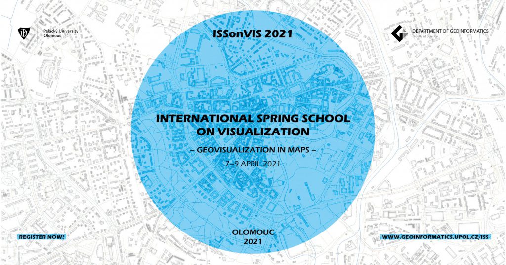
ISSonVis 2021
“ISSonVis 2021”
International Spring School on Visualization
— Geovisualization in Maps —
7-9 April 2021
Online Venue: Department of Geoinformatics (Palacký University Olomouc, Czechia) via GatherTown webtool
Topics: Visual analytics, spatial and temporal data visualization, mapmaking in open source geospatial tools, multivariate mapping
Experts:
- Menno-Jan Kraak (University of Twente, Netherlands)
- René Sieber (ETH Zurich, Switzerland)
- Aileen Buckley (Esri, USA)
- Topi Tjukanov (Gispo, Finland)
- Gennady and Natalia Andrienko (Fraunhofer Institute IAIS, Germany & City, University of London, UK)
Local organizers and “buddies”:
- Vít Voženílek – Spring School 2021 coordinator and supervising lecturer
- Vít Pászto – Spring School 2021 coordinator and admin support
- Rostislav Nétek, Alena Vondráková, Stanislav Popelka – experts’ buddies
ISSonVis mission:
Geovisualisation is a broad term referring to a visualisation of geospatial phenomena. It has been gradually gaining importance for more than 20 years. Moreover, various forms of geovisualisations are now penetrating many disciplines that do not primarily focus on working with geospatial data. Therefore, it is important to raise awareness of the basic principles of geovisualisation techniques and educate future practitioners about the proper design and application of geovisualisations.
The International Spring School on Visualization (ISSonVis) offers an opportunity for the encounter of students, scholars, and experts in the field of geovisualisation. It is designed to introduce students to contemporary advances in geovisualisation covering aspects of map design, web cartography, desktop publishing and others via a series of lectures, workshops and practical sessions. Teaching and learning sessions will be led and supervised by well-known experts in geovisualization. Moreover, the Spring School strives to establish an open platform for participants to bring their experiences, ideas, data, and projects to share, work, present, and discuss. The Spring School primary focus is to provide and transfer new geovisualisation skills, techniques, and knowledge both ways – from scholars/experts to the students, and vice versa.
The International Spring School 2021 is designed to be ONLINE and dedicated to students (Bachelor, Master, PhD).
So far, we have officially received auspices from the Czech Cartographic Society (patronage here).
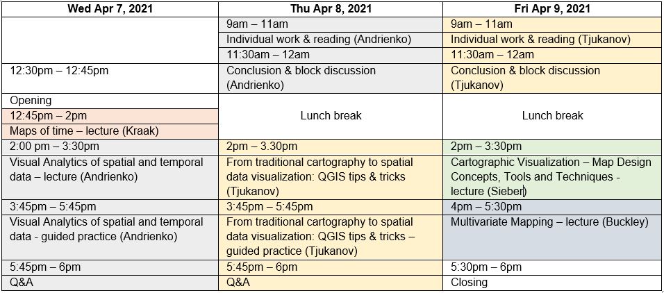
Preliminary programme (all times in CET):
Registration & Fee
The registration fee is set to be a “flat” price of 45 EUR (special covid-19 price) and allows to:
- access to all lectures and workshops led by internationally renowned experts
- gain new knowledge in the field of geovisualisation
- have an opportunity to discuss own work with:
- other students
- international experts
- and expert buddies from the department of geoinformatics
- get new international contacts useful for future career
- get access to all learning and teaching materials
- certificate of attendance
- ECTS credits (where applicable)
BIOs
[widgetkit id=”1″]
Payment method
By bank transfer – 45 EUR, in Euro (EUR) only!
- Bank: KOMERČNÍ BANKA (KB)
- IBAN: CZ9801000000433855090287
- Account number: 43-3855090287/0100
- SWIFT: KOMBCZPPXXX
- Variable symbol: 993105501
- Message for recipient: “your name” + “variable symbol” above (in case of international transfers)
You will be provided with a receipt/invoice upon payment.
Payment must be made by 1 April 2021.
Registration form
